
 The Driving Range Forest and Trails Project is a conservation and outdoor recreation initiative in Bolton, Vermont that permanently protects 203 acres of priority forestland through a conservation easement acquired by the Vermont Land Trust (VLT). The project serves a dual mission: preserving critical wildlife habitat and securing permanent public access to a nationally significant adaptive trail network.
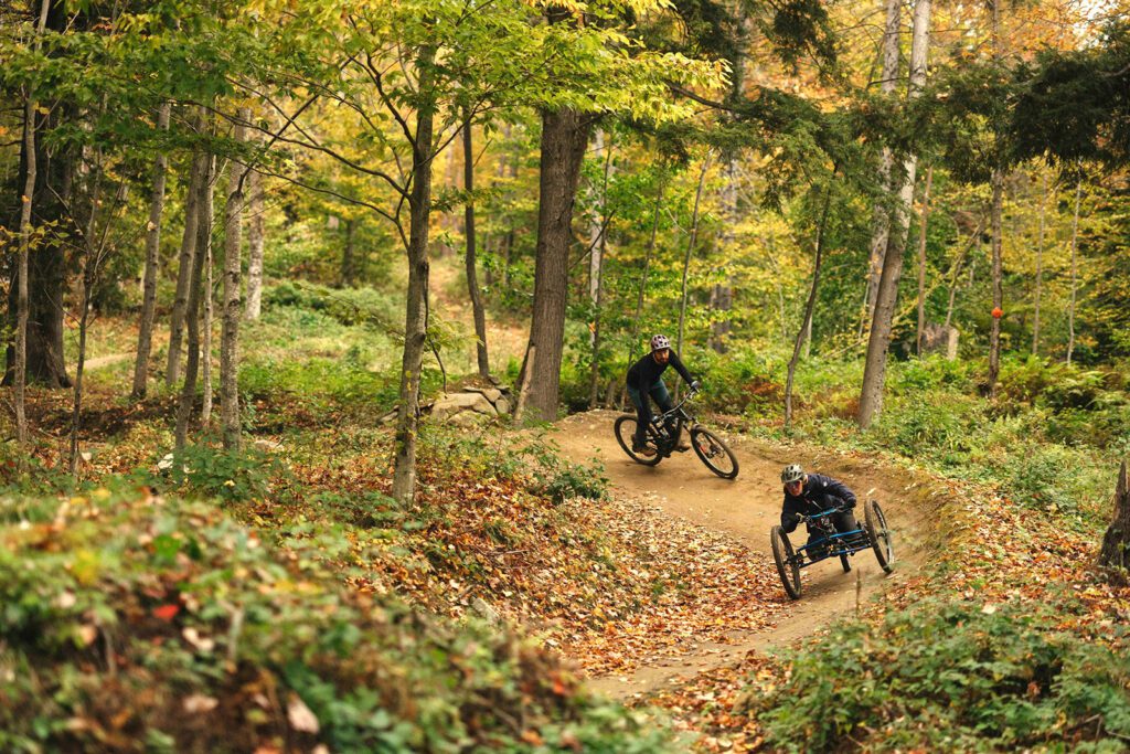
At the heart of the project is the Driving Range trail network — the first and only mountain bike trail system in the world intentionally designed to be fully adaptive-ready from the outset. With nearly 3,900 users tracked in a single month in 2025 and growing international recognition, including a feature in Outside Online’s 2026 Travel Awards, the network offers inclusive outdoor recreation for disabled and non-disabled users alike. The project permanently protects five miles of these trails through a trail easement to Richmond Mountain Trails, as well as a one-mile segment of the 300-mile Catamount Nordic Ski Trail.
The property sits at a critical linkage in the Reconnecting the Greens – Mt. Mansfield to Camels Hump Wildlife Corridor, a landscape-scale partnership of 14 organizations focused on connecting 127,000 acres of intact forest along Vermont’s Green Mountains. The Vermont Agency of Natural Resources identified this corridor as one of the ten most important landscape-scale corridors in the state. The project directly links 63,000 acres of conserved land to the north with 31,000 acres to the south, supporting genetic exchange among wildlife populations and long-term climate resilience. The property also protects 13 acres of rare Silver Maple-Ostrich Fern Floodplain Forest, a half-mile of Winooski River frontage, and over two miles of headwater stream frontage, helping buffer downstream communities from increased flooding driven by climate change.